HIKING ADVENTURE – Moreton Island (Mulgumpin) NATIONAL PARK
Depart Brisbane 7:00am Monday & Thursday
4 DAY Moreton Island (Mulgumpin) HIKE ADVENTURE – SOUTH
Depart Brisbane – 7:00am Brisbane Transit Centre: Bus Stop 125 on Roma Street (Street level)
Board the Micat ferry at the Port of Brisbane at 8:00am
Cruise Moreton Bay Marine Park - see dolphins, turtles & whales (in season) to the Tangalooma Shipwrecks on the west coast of Moreton Island (Mulgumpin).
Day 1: Hike south past Tangalooma Point to eroding steam ships and high sand cliffs (5km).
Continue along the beach 5km to the Big Sandhills. Feeling fit? Hike the first two sand ridges & return to the west coast.
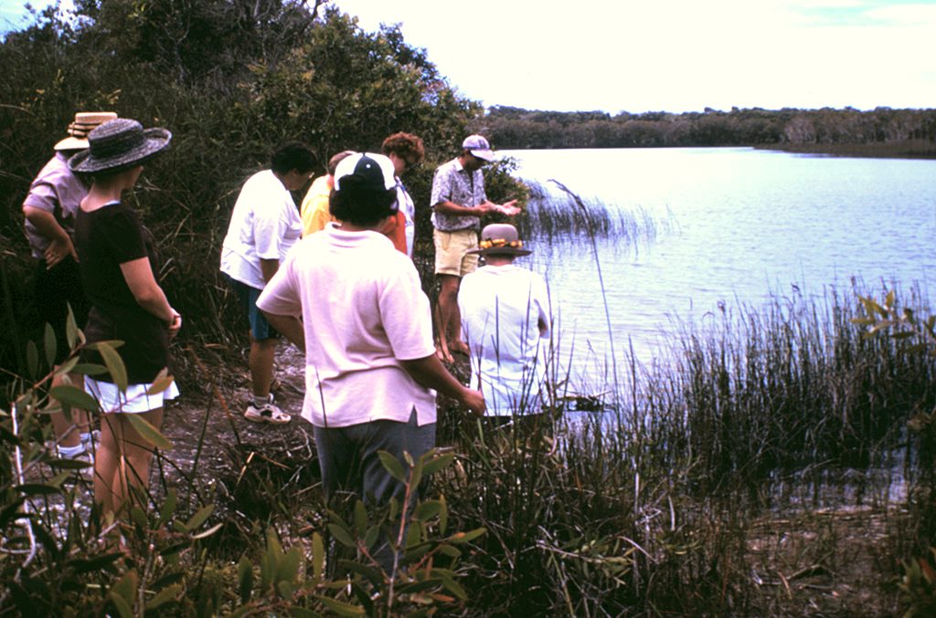
For the non climbers, briefly explore the eel grass beds on the sandbars which are full of marine life.
Hike south along the track running through the mangrove forest.
This forest continues along the Bay foreshore to the Toulkerrie Oyster Farm (5km) and onto the Kooringal township, one of Moreton Island's best kept secrets.
On the low incoming tide the eel grass beds are an experience.
Day 2: Walk across the southern tip of Moreton Island (Mulgumpin) to the east coast. (2km) Views to the south look over North Stradbroke Island.
The Mirapool Lake region reserve is a protected fish breeding and bird rookery area. Hike around the point or along the 4WD track to the Little Sandhills.
This low lying sand region supported Aboriginal settlements in days past – Do not disturb (2km)
Hike north along the beach past the Little and Big Sandhills (the same you passed on the west coast) and along to Rous Battery fortifications on the high cliffs. (5km)
Continue north along the beach – past the ancient midden sites to Middle Road – Beach hike (5km)
Middle Road is the 4WD track joining the East & West coasts. (Vehicle support is provided here)
Hike the last 10km along the beach, past the Bulwer road to Blue Lagoon – a freshwater lake and your campsite for night 2.
- All camping equipment
- Food & drinks
- Shower & amenities
- Campfire
- Night swim in Blue Lagoon
- Deserted Eastern surf beach
- Solar lighting & tables at camp
Day 3: Breakfast. Swim. Watch the sunrise. Photo opportunities at Blue Lagoon.
Hike the Bulwer track commencing with a trail through the wallum heath to Honeyeater Lake. A 2km journey of flowering plants and singing birdlife.
Head up coastal hills of Eucalypt forest and trackside foxtail fern onto Howards Range which runs south along the centre of Moreton Island (Mulgumpin). (5km)
On top of the range, turn south along the Telegraph Route hiking trail which is a tough hike for 7km and arrive at the foot of Mount Tempest hike. (7km)
Hike the the highest oceanic sand ridge in the world. This hill is stepped in parts and offer extensive views. (3km return)
Proceed south along the track to Middle Road and commence the hike back to the west coast (vehicle assistance) up over the range through the coloured sandhills and down the other side with Xanthorrhoea forest (Grass trees) Angophora costata (gum), Scribbly gum and down to the west coast beach at Ben Ewa. (7km) Camp the night at Ben Ewa.
Day 4: Hike to the Desert a natural sandblow and return through the Tangalooma Wild Dolphin Resort. Hike to the historic Cowan fortifications and 'No Vehicle Zone' beach. Explore the west coast creeks and swamp land.
- Snorkel Tangalooma Wrecks (guided)
- Sandboard the Desert (guided)
- Fish, kayak Moreton Bay & shipwreck
- Swim – spot dolphin, turtle, dugong & more
- Campfire overlooking the beach
Phone 1800 353 717 for prices and bookings for this tour
HIKING ADVENTURE – Moreton Island (Mulgumpin) NATIONAL PARK
Depart Brisbane 7:00am Monday & Thursday
4 DAY Moreton Island (Mulgumpin) HIKE ADVENTURE – NORTH
Depart Brisbane – 7:00am Brisbane Transit Centre: Bus Stop 125 on Roma Street (Street level)
Board the Micat ferry at the Port of Brisbane at 8:00am
Cruise Moreton Bay Marine Park - see dolphins, turtles & whales (in season) to the Tangalooma Shipwrecks on the west coast of Moreton Island (Mulgumpin).
Day 1: Disembark the ferry.
Commence your hike north – along the beach. Look for dugong, dolphin and turtles close to shore.
- ½km - Shipwreck sandhill
- 1km - Pass the Middle Road sign to the east coast – No not enter
- 2km - Ben Ewa Ranger base. Main National Park office on Moreton Island (Mulgumpin).
- 2½km - Ben Ewa camp site and Sunrover's base camp.
- 4½km - Slightly off the beach. Tangalooma airstrip
- 5km - Cowan Point camp ground
- 6km - Cowan World War II bunkers & boxes. Township of Cowan Cowan.
- 10km - Bulwer shipwrecks. Notice the Bulwer township, 200m from the beach Bulwer Store.
- 11km - 4WD entrance track to Comboyuro camp ground. Toilets 100m inland.
- 12km - Comboyuro Point
- 13km - Dog Creek. (sometimes not visible)
- 14km - Tailor Bite – a great fishing spot in the winter months. (Sign difficult to spot)
- 16km - Heath Island – A wetland protected region. Walk across Main Creek with backpack kept high on your shoulders. Follow any 4WD tracks. Rare birds including Jabiru often seen in the lagoon and fish below the high sand hills (Five Hills)
- 17km - Yellow Patch sandhill.
- 18km - Ocean front swamp.
- 19km - Follow road inland to North Point camp site. Walk off the beach across the swamp and turn left (100m)
- 20km - You have arrived at North Point camp site. Your tent is erected for you. Toilets and outdoor shower are also here. Walks to Honeymoon Bay and Blue Lagoon Bay. Northern beach walk in the evening.
Day 2: Return to Honeymoon Bay for sunrise over the Pacific Ocean and Flinders Reef. After breakfast hike to the eastern end of camp site with your pack onto the gravel road and hike gently up to Cape Moreton and the lighthouse – Queensland's oldest lighthouse, built in 1867 from sandstone quarried onsite. Look out here for whales (April-October), turtles, manta rays, dolphins and more. (2km)
Return back to the gravel road (100m) to the 44 gallon drums to track to Boulder Beach. This is a tough hiking track down to an isolated region with caves on the northern end (accessible only on low tide) and small sandblow on southern end. Hike back up the sandblow to the lighthouse, or return the way you came.
Take the 4WD gravel road down to the eastern beach. This is called Harpers Rock. (Named after an early lighthouse keeper) Climb up this rock through excellent coloured sand formations with views down Moreton Island's eastern beach. (2km) A small cove around from Harpers Rock (100m) is an excellent private beach below the cliffs.
Walk south along the eastern beach to Spitfire Creek. (4km) Spitfire Creek is an overflow from Lake Jabiru. The indigenous Ngugi (pronounced Noo Gee) people used this fresh water and sandblow behind, to enhance their lifestyle with midden sites recorded in this freshwater oasis. Hike on along the beach to the next freshwater creek Blue Lagoon overflow and another 300m to Blue Lagoon camp site track with sign on the beach. (5km)
Walk off the beach into the camp site and take the first turn right and located 50m to the right is Sunrover's base camp on the east coast. Showers & toilets are here. Tents are erected & waiting for you.
- Campfire
- Swim Blue Lagoon
- Freshwater lillies
- Local stories & night life
- Put your feet up!
Day 3: Itinerary as South Trip